Many photographers add aerial/drone photography as an afterthought. They aren’t very excited about it. If you want to stand out against the competition, you need a drone specialist.
Real estate aerial photography and video are powerful tools that provide a unique perspective on properties for sale. These services allow buyers to get a bird’s eye view of the property, neighborhood and surrounding areas, giving them a more complete understanding of the property and its potential.
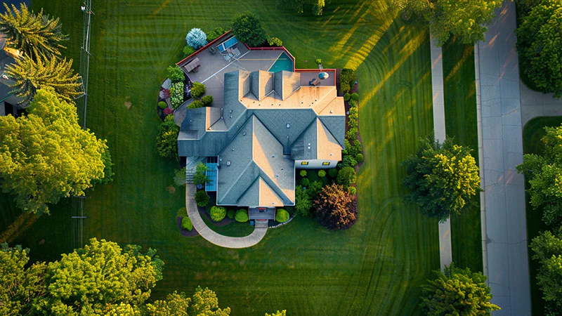
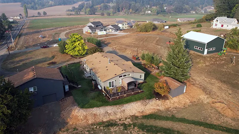
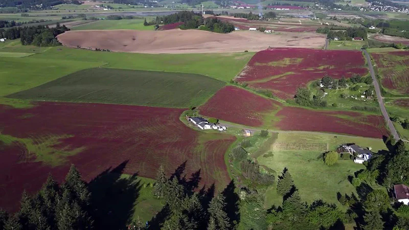
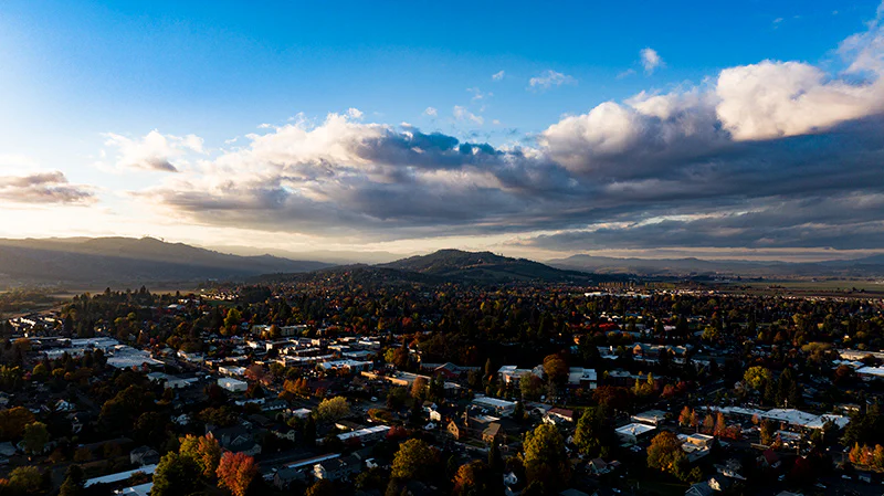
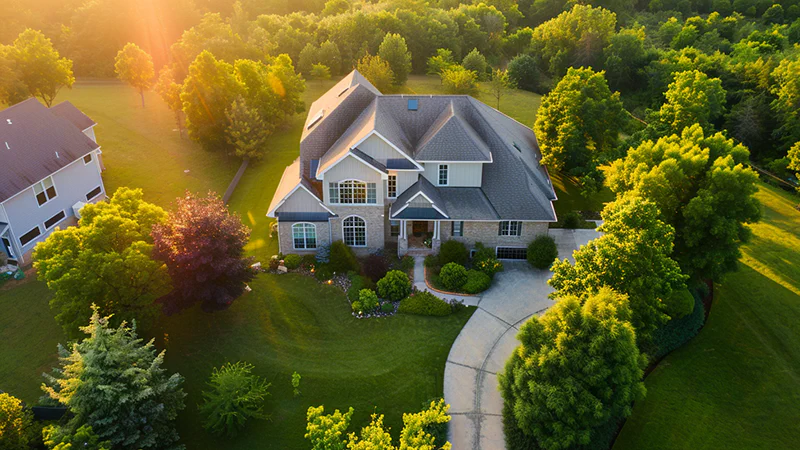
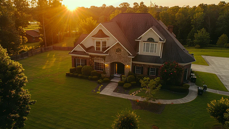
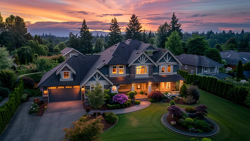
Here is a sample of what you can build for you
Aerial photography and video can showcase large properties, including acreage and waterfront properties, in a way that ground-based photography simply cannot match. These services can also be used to highlight the location of a property in relation to nearby amenities such as shopping centers, parks, and schools.
Aerial videos are particularly useful for properties with large outdoor spaces such as pools, gardens, and decks. These videos can give buyers a sense of the scale and layout of the property, and allow them to envision themselves living there.
In addition to being beneficial for buyers, aerial photography and video can also be helpful for sellers. These services can be used to showcase a property’s unique features, and to help it stand out in a crowded real estate market.
Overall, real estate aerial photography and video provide a comprehensive and engaging way to view a property, making it an essential tool for anyone looking to buy or sell real estate.
We offer:
- High Quality, cinematic and engaging video in 4K
- Beautiful high definition images
- We highlight the features you think should stand out.
Aerial photography has revolutionized the way real estate professionals showcase properties to potential buyers. By capturing stunning bird’s eye views, aerial photography provides a unique perspective that highlights a property’s best features and its surrounding environment. In this article, we’ll explore what aerial photography is, how it’s used in real estate, and answer some frequently asked questions.
What is Aerial Photography?
Aerial photography is the process of capturing photographs from an elevated position, typically using an aircraft, drone, or satellite. This type of photography offers a vantage point that is impossible to achieve from the ground, providing a comprehensive view of a subject and its surroundings.
How is Aerial Photography Used in Real Estate?
In the real estate industry, aerial photography is used to showcase properties in a way that captures their true essence and setting. Here are some ways aerial photography is used in real estate:
Property Listings: Aerial photographs are often included in online property listings to give potential buyers a better understanding of the property’s layout, size, and features.
Marketing Materials: Aerial shots are used in brochures, flyers, and other marketing materials to make properties stand out and attract more attention.
Virtual Tours: Aerial footage can be incorporated into virtual tours, allowing potential buyers to experience a property from multiple angles and get a feel for its surroundings.
Property Analysis: Aerial photography can be used to assess a property’s condition, identify potential issues, and plan for future development or renovations.
Benefits of Aerial Photography for Real Estate
Aerial photography offers numerous benefits for real estate professionals and their clients:
Increased Engagement: Aerial photographs capture attention and encourage potential buyers to explore a property further.
Better Visualization: Aerial shots provide a comprehensive view of a property, helping buyers understand its layout and surrounding area.
Competitive Advantage: Properties with aerial photographs stand out from the competition and can generate more interest from potential buyers.
Time and Cost Savings: Aerial photography eliminates the need for multiple ground-level shots, saving time and money for real estate professionals.
FAQs
1. What equipment is used for aerial real estate photography?
Aerial photography for real estate typically involves the use of drones, also known as unmanned aerial vehicles (UAVs). These drones are equipped with high-resolution cameras that capture stunning images and videos from various angles and heights. We sometimes use a combination of Drones, and DLSR cameras on Gimbals to acheive the perfect video.
2. Is drone photography legal for real estate?
Yes, drone photography is legal for real estate purposes in most areas. However, drone operators must follow strict regulations set by the Federal Aviation Administration (FAA), such as obtaining a Remote Pilot Certificate, keeping the drone within visual line of sight, and respecting privacy laws. We only use Part 107 pilots and follow all FAA regulations and local laws.
3. How much does aerial real estate photography cost?
The cost of aerial real estate photography varies depending on factors such as the size of the property, the location, and the photographer’s experience. On average, prices can range from $300 to $1000 per session, depending on complexity.
4. Can aerial photography be used for interior shots?
While aerial photography is primarily used for exterior shots, some drone operators use specialized drones to capture interior photographs and videos. These drones are smaller and equipped with obstacle avoidance technology to navigate indoor spaces safely. We can perform these types of shots as well.
Conclusion
Aerial photography has become an essential tool for real estate professionals looking to showcase properties in the best possible light. By providing a unique and comprehensive perspective, aerial shots capture attention, increase engagement, and help potential buyers visualize a property’s true potential. As drone technology continues to advance, the possibilities for aerial real estate photography are endless.
Contact me so we can talk about your project!